
Federal court: no warrant is required for law enforcement to track your location via cell phone records
By Madison Ruppert
Editor of End the Lie
August 1, 2013

(Image credit: Nicola since 1972/Flickr)
A federal appeals court has ruled that law enforcement agencies are not required to obtain a warrant in order to track your location through your cell phone records.
This is hardly a surprising decision given that other judges have said that cell phone users have “no legitimate expectation of privacy,” some in the house have said no warrant should be required to acquire geolocation data, and the Obama administration claims location data is not protected by the Fourth Amendment.
The Fifth U.S. Circuit Court of Appeals in New Orleans supported this trend earlier the week by overturning a federal judge in Houston, according to the Wall Street Journal.
The court ruled that cell phone records are the property of your carrier and thus are not protected by the Fourth Amendment’s probable cause standard.
However, authorities must still get a court order in order to carry out a search of your cell phone records, though the standards are much lower than those required for search warrants.
Those searches are now capable of tracking your recent movements since location data is included.
“We understand the cell phone users may reasonably want their location information to remain private,” the Appeals Court stated, according to an Associated Press report.
“The Fourth Amendment, safeguarded by the courts, protects only reasonable expectations of privacy,” the court ruled.
Unsurprisingly, the American Civil Liberties Union (ACLU), which participated in the case by filing legal briefs, called the ruling “troubling.”
“This ruling is troubling because, as we and the Electronic Frontier Foundation (EFF) argued, only a warrant standard fully protects Americans’ privacy interests in their locations and movements over time,” the ACLU said in a statement, which was also posted in part by CNET.
“Cell phone companies store records on where each of us have been, often stretching back for years,” the ACLU continued. “That location information is sensitive and can reveal a great deal — what doctors people visit, where they spend the night, who their friends are, and where they worship.”
“Given the sensitivity of these facts, law enforcement agents should have to demonstrate to a judge that they have a good reason to believe that they will turn up evidence of wrongdoing before gaining access to information that can paint a detailed picture of where a person has been over time,” the ACLU argued.
I’d love to hear your opinion, take a look at your story tips and even your original writing if you would like to get it published. I am also available for interviews on radio, television or any other format. Please email me at Admin@EndtheLie.com
Please support alternative news and help us start paying contributors by donating, doing your shopping through our Amazon link or check out some must-have products at our store.
Storms in North-Central States being Shaped by NEXRAD
by Joseph Cek
Geoengineering Watch: Calgary, Alberta
July 22, 2013
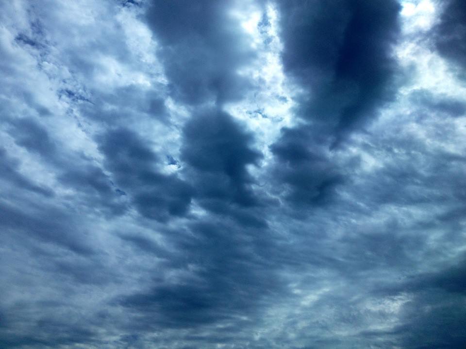
Update: We have recent video footage here, depicting the sky of Upper Michigan that was also closely linked to this storm system. The resident who witnessed this, Jason Asselin, describes it as:
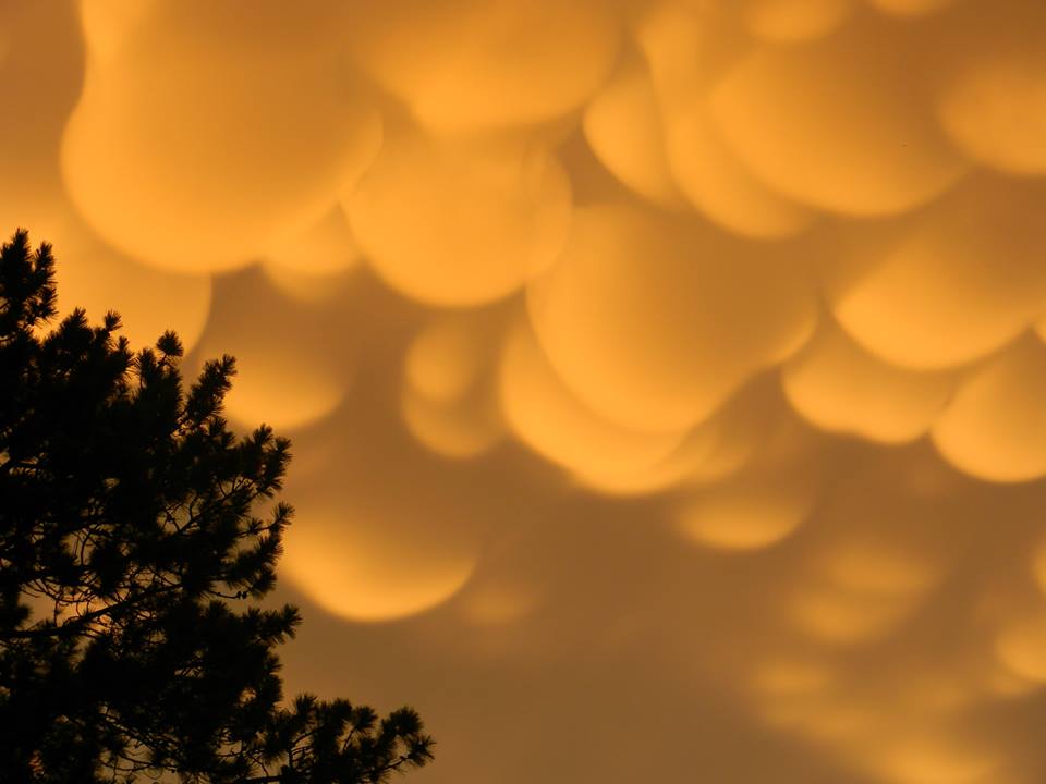 |
| Skies in Upper Michigan on the evening of July 22 |
A storm system stretching from Nebraska, to Iowa and Wisconsin has been analysed, and it appears that this storm is being largely shaped by NEXRAD stations working in conjunction with each other. Please see our playlist, which clearly depicts the KOAX and KDMX NEXRAD stations involved in generating tapered linear storm systems.
 |
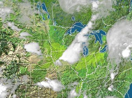
| Fig 1: Top image is a satellite portrayal of this storm system with its linear arm stretching into the Northern States and Canada. The bottom image is a satellite showing the current water vapour during this time. Watch the video here. |
 |
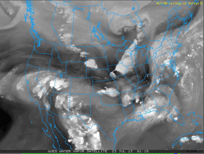
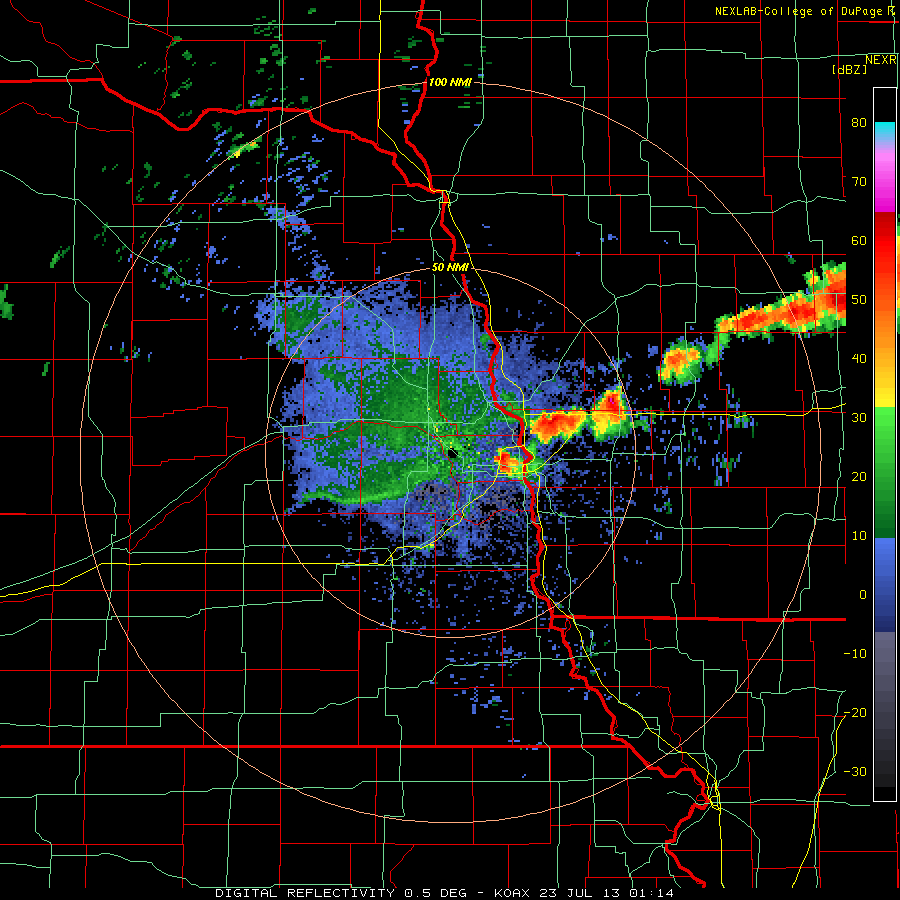
| Fig 2: Moisture being bridged from KOAX to KDMX NEXRAD stations on July 23 at 01:15 UTC. This is shown in more detail using the radar stations (Fig 5) below. |

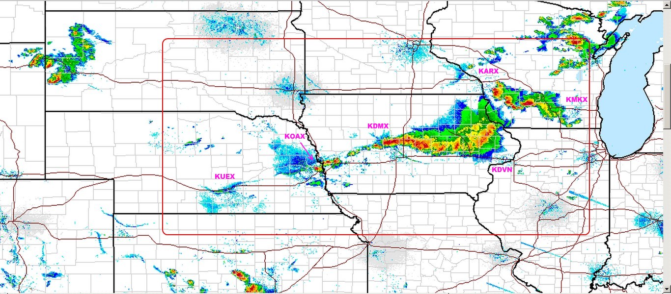 |
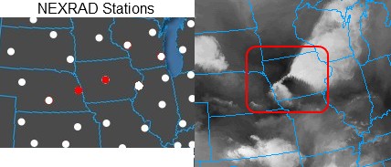
| Fig 4: Radar image showing moisture content of the storm system that we are interested in. Take note of how this storm system is tapered towards active NEXRAD stations, and is connected through numerous radar stations. The images that follow below will portray this in more detail. The stations from left to right are KUEX, KOAX, KDMX, KARX (top), KDVN (bottom), and KMKX. Watch the video here. |
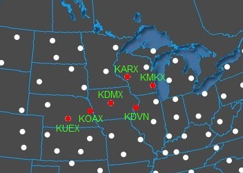 |
| Fig 5: NEXRAD stations in the U.S. The red dots represent those that we are interested in analysing. Use this figure to correlate with the radar images that follow. |
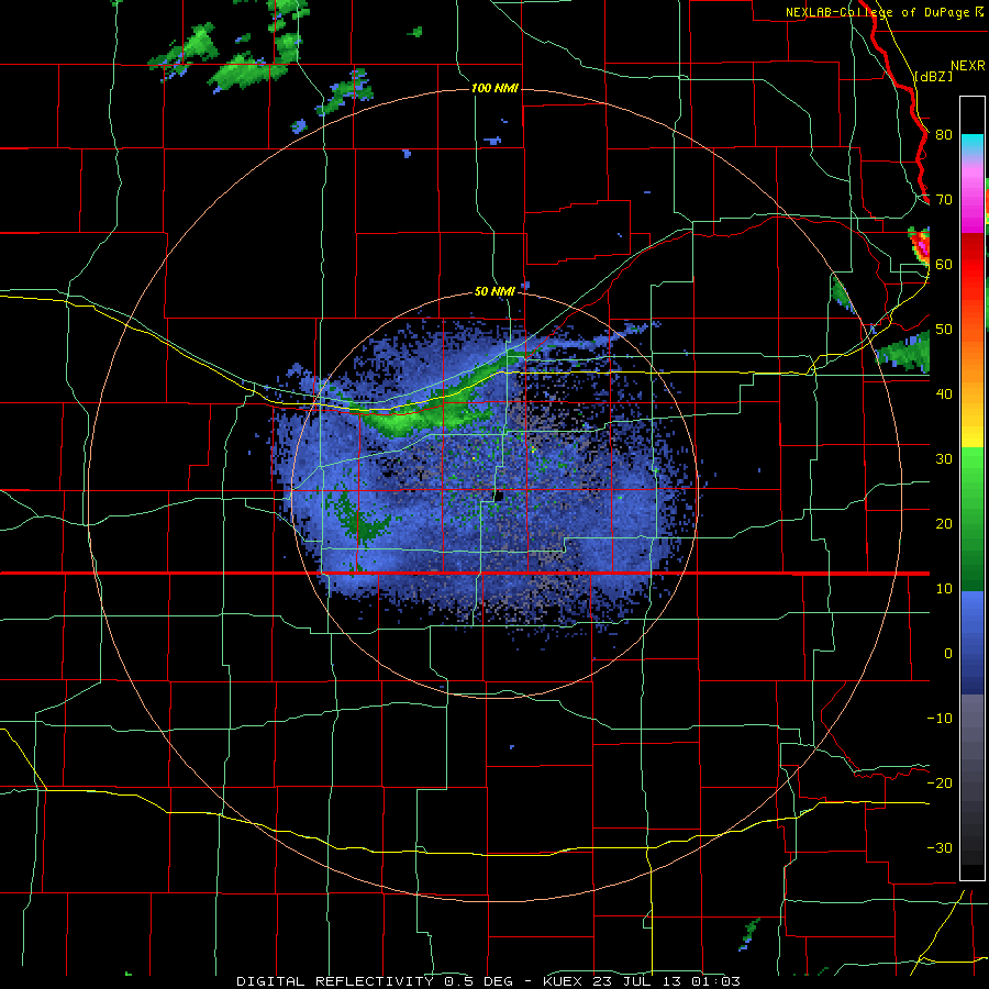 |
| Fig 6: Grand Island/Hastings, NE (KUEX) NEXRAD Station. This is consistent with Fig 4. |
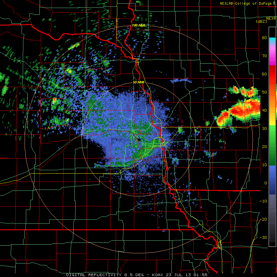 |
| Fig 7: Omaha, NE (KOAX) NEXRAD Station. This is consistent with Fig 4. |
 |
| Fig 8: Des Moines, IA (KDMX) NEXRAD Station. This is consistent with Fig 4. |
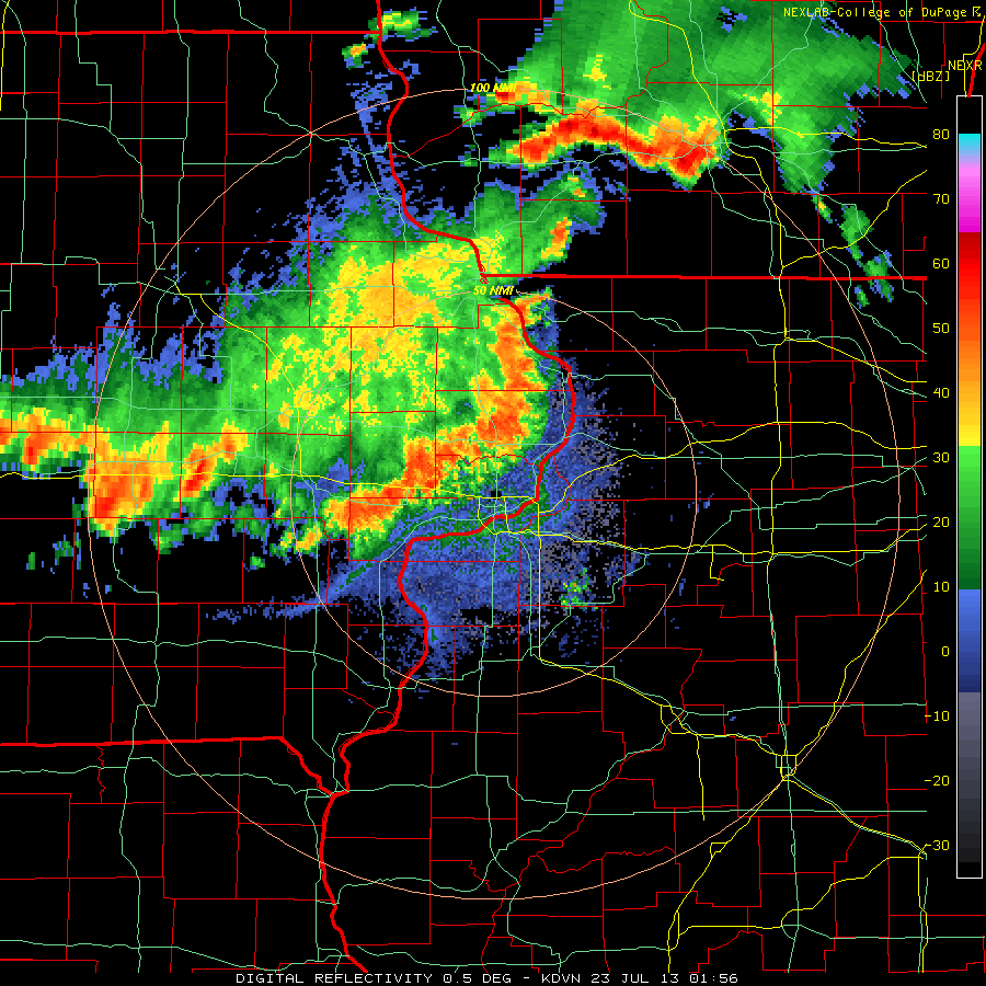 |
| Fig 9: Davenport, IA (KDVN) NEXRAD Station. This is consistent with Fig 4. |
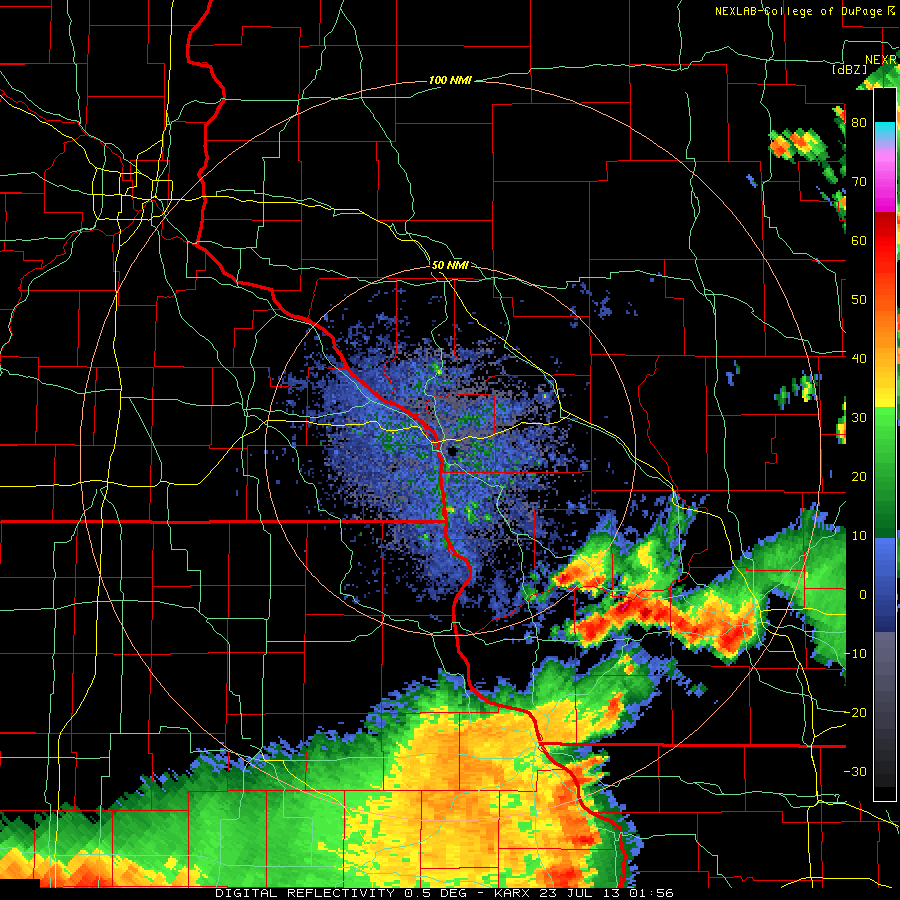 |
| Fig 10 La Crosse, WI (KARX). This is consistent with Fig 4. |
 |
| Fig 11: Milwaukee, WI (KMKX) NEXRAD Station. This is consistent with Fig 4. |
More investigation is needed with these radar anomalies and their apparent influence on storm systems and moisture-driven forces. Provided below is a list of useful tools for capturing these type of events. It is important to become familiar with these software tools. We recommend adding them to your bookmarks:
VIDEO — Obama Pays Al Qaeda $150 Per Month In Syria
Syrian Girl
July 28, 2013
The US openly admits it gives the Syrian insurgents 150 USD per month, interestingly the exact same wage Al Qaeda is getting.
MUST SEE — 7/24/2013 — Dr. Nick Begich corrects the false ARRL article — HAARP has NOT shut down
Dutchsinse
July 24, 2013
Many thanks to Dr. Nick Begich for doing the hard investigative work — thanks for correcting these false rumors that “HAARP has shut down”.
We have fully debunked the ARRL anonymously authored fake report that HAARP is “abandoned”. We posted the budgets for 2013 and 2014 (Airforce and DARPA) . We posted the EXPERIMENT SCHEDULE for 2013 and 2014 (DoD and US Airforce). We even posted the diesel generator information, proving the ARRL author doesn’t even know how HAARP is powered.
http://tatoott1009.com/2013/07/22/dr-nick-begich-corrects-the-arrl-on-7222013-haarp-is-in-operation/
Again, many thanks to Dr. Begich for shedding light on this situation, and for stopping this rumor dead in its tracks.
_____
Be sure to go directly to the site Dr. Begich manages. His site, Earthpulse, is a great source of information. Personally, I have a tremendous amount of respect for Dr. Begich, his work is unparallelled.
If you haven’t already purchased copies of his famous books on HAARP — here is a link to check out the different editions:
BREAKING: Attempted Set-Up of Stewart Rhodes & Dan Johnson With Child Porn
YouTube — StormCloudsGathering
July 24, 2013
BREAKING: Attempted Set-Up of Stewart Rhodes & Dan Johnson With Child Porn
[related: VIDEO — Attempted Setup of Luke Rudkowski]
MUST SEE — Obama Supporters Petition to Grant Him Immunity for All Crimes He Commits While in Office
Mark Dice
July 22, 2013
Obama supporters in San Diego, California petition to grant the President immunity for any crimes he has committed or will commit while in office. Media analyst and author Mark Dice simply asks random people if they’ll sign a petition to support Obama by granting him immunity for his crimes, and one person right after the other signs it to show support for dear leader.
Take a look at Mark’s previous Man on the Street crazy petition videos and subscribe to to http://www.YouTube.com/MarkDice to see what happens next week, and check out his books in paperback on Amazon.com or e-book on Kindle, iBooks, Nook, or Google Play.
U.S. NEXRAD Stations Generate & Feed Clouds to Canada Doppler Stations
by Joseph Cek
Geoengineering Watch: Calgary, Alberta
July 17, 2013
 |
| Above: Photos depicting Calgary’s sky on July 17, roughly 11:00 am, facing East. Notice the linear arms of this storm system that are similar to the pulsing anomalies we see in radar viewed from Doppler stations. We believe that the Doppler stations are helping to move these clouds, and as a result shapes them with electromagnetic signatures. |
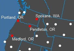
We can clearly see clouds being generated as plumes in Oregon and Washington NEXRAD Stations, which are then driven north east into British Columbia, with the help of Canada’s Doppler stations co-operating to bring this cloud system into Alberta. Most of the moisture and clouds are being driven north east from the Spokane, WA Station towards the Vernon Doppler station to end up in Alberta and eventually Calgary.
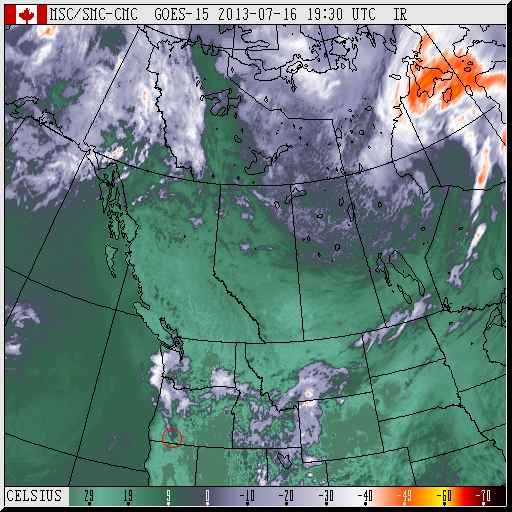 |
| Above: Satellite image of Western Canada on July 16, 19:30 UTC. Pay attention to the tapering plume generated near Medford, OR on the bottom left. |
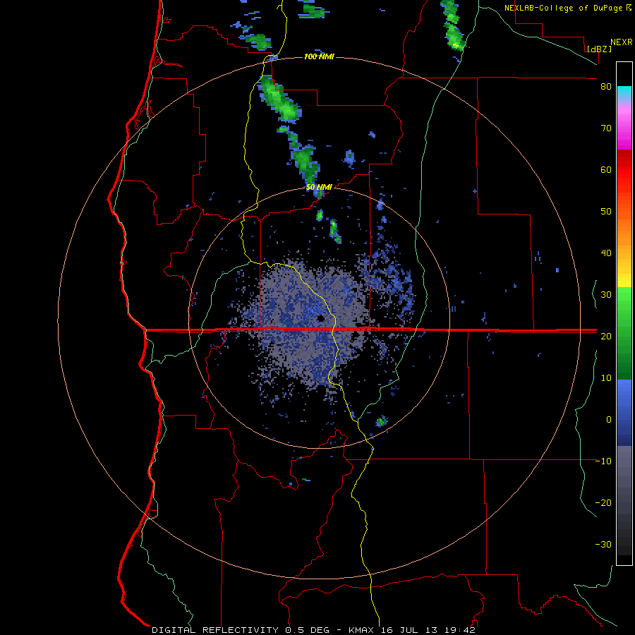 |
| Above: Medford, OR NEXRAD Radar: Tapering plume generated precisely from the Medford, OR (KMAX) Station |
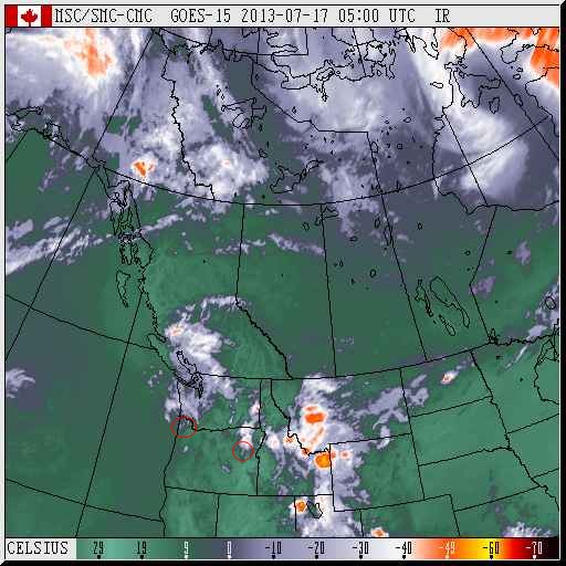 |
| Above: Western Canada satellite image for July 17, 5:00 UTC. Pay close attention to the plume-shaped clouds generated at Portland, OR (left) and Pendleton, OR (right). |
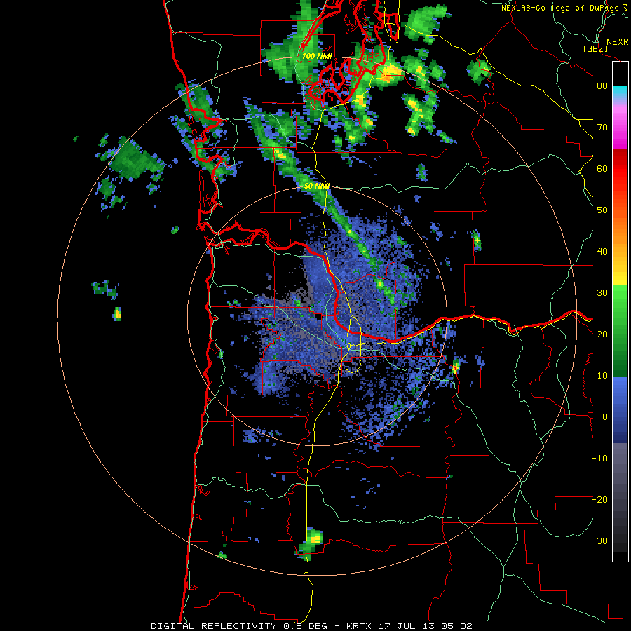 |
| Above: Portland, OR (KRTX) NEXRAD Station on July 17, 5:02 UTC, generating a tapered cloud system that was seen on satellite images. |
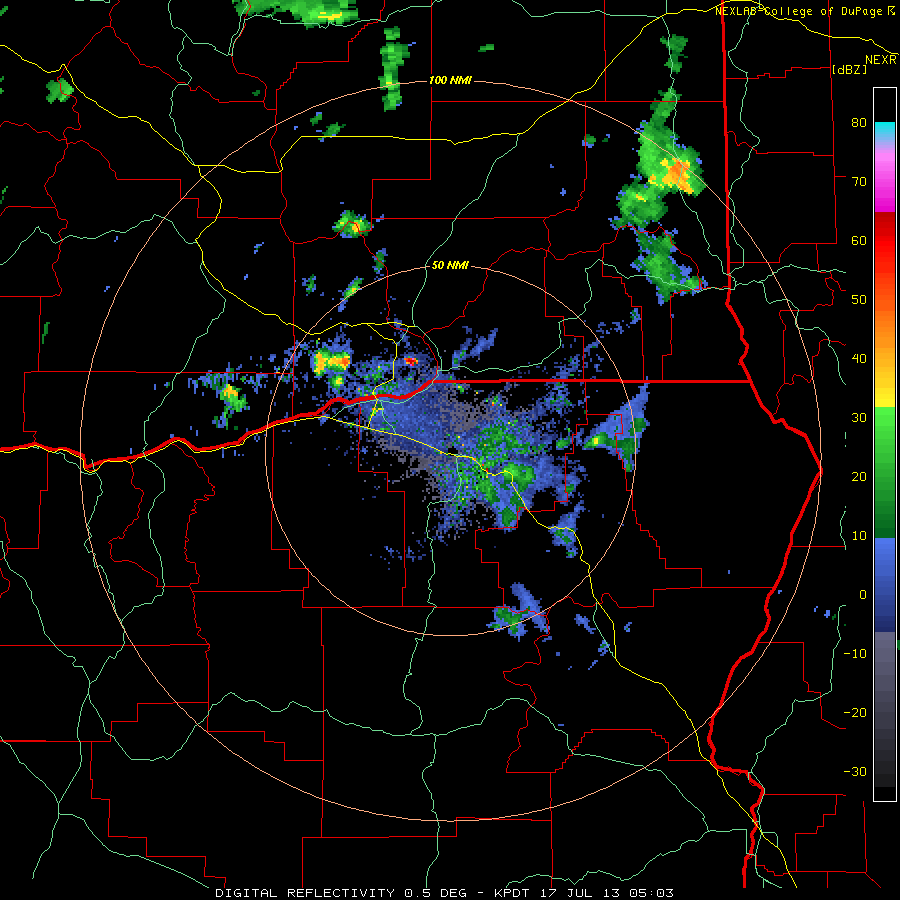 |
| Above: Pendleton, OR (KPDT) NEXRAD Station on July 17, 5:03 UTC, seen generating a tapering plume-shaped cloud system as seen on satellite images. |
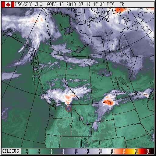 |
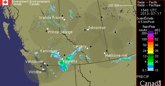
| Above: Western Canada satellite image for July 17, 17:30 UTC. Pay attention to the plume-shaped cloud system originating near Spokane, WA. |
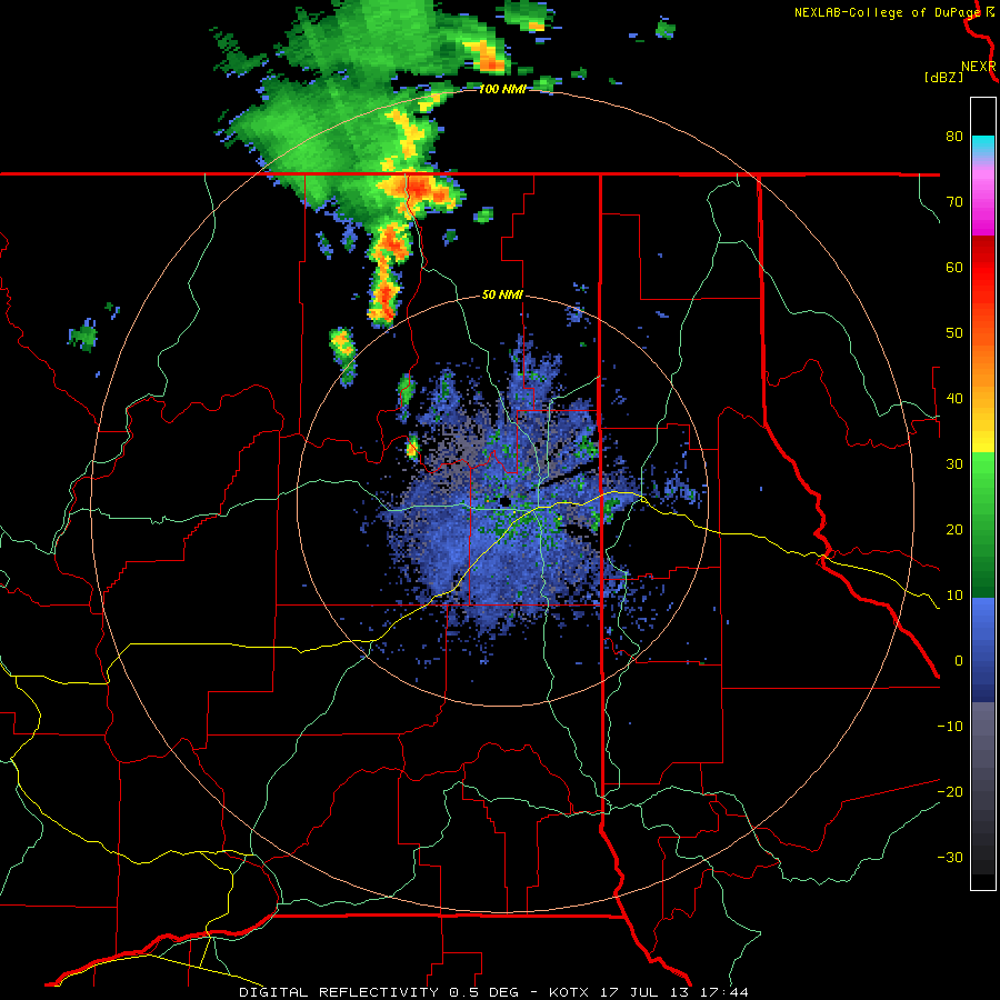 |
| Above: Spokane, WA (KOTX) NEXRAD Station on July 17, 17:44 UTC, seen generating a tapered plume-shaped cloud system. |
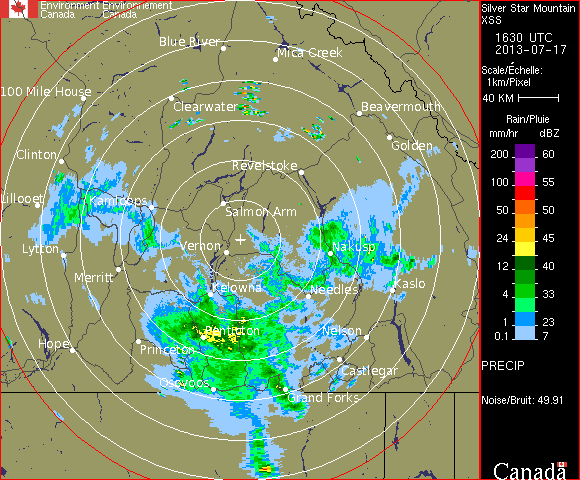 |
| Above: Vernon, BC (Silver Star Mountain) Doppler Station receiving the cloud system that originated in Washington, and driving this system towards the Calgary Doppler Station. The time is July 17, 16:30 UTC. |
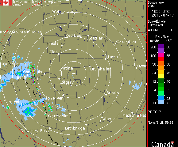 |
| Above: Strathmore, AB (near Calgary) Doppler station receiving the cloud system from British Columbia (Vernon Doppler Station), that originated from Washington. The timing is July 17, 16:30 UTC (10:30 a.m. MDT). |
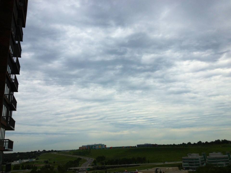 |
| Above: Calgary’s sky, facing north. We see the electromagnetic ripples as signs that a Doppler station has left its mark on these clouds. This is the signature of electromagnetic-induced clouds. All morning photos can be viewed here. |

