
MUST READ: Floods in Southern Alberta caused by NEXRAD Stations in the United States – SHOCKING EVIDENCE [video included]
by Joseph Cek
Geoengineering Watch: Calgary, Alberta
June 21, 2013
[UPDATE: Major Flooding In Alberta- Could it Be Linked to Geoengineering?]
Firstly, we are surprised that none of the major media outlets have mentioned that the heavy rainfall southern Alberta received in the past two days originated from southern Montana. We will describe how the recent weather pattern formed, which brought majority of the recent flooding of rain, accompanied by videos. A playlist of all events can be viewed here.
Regarding the video below, pay close attention to the storm originating in southern Montana which moves into southern Alberta. At about 11 seconds in, we see a tapering arm stretching south to the Wyoming-Idaho border, which later feeds the southern end of the storm for some time. This storm system moves east to join other storms that originated in North and South Dakota. Also pay attention around these areas of North and South Dakota, to see how storm systems mysteriously originate from central points. It is important to note how some of these storm systems are tapered , originating from a central point. These central points will later be shown to be NEXRAD (Doppler) sites, which can emit electromagnetic waves at different frequencies that affects weather patterns. Where the cursor is throughout the video are points of interest:
What is interesting about where some of these storm systems are developing is that they are either on, or near close proximity to NEXRAD stations. Here is a snapshot of where the south Montana storm originates, which is near the KBLX NEXRAD Station in Billings, MT:
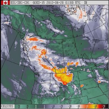 |
| Environment Canada Satellite Image: South Alberta storm originates from south Montana |
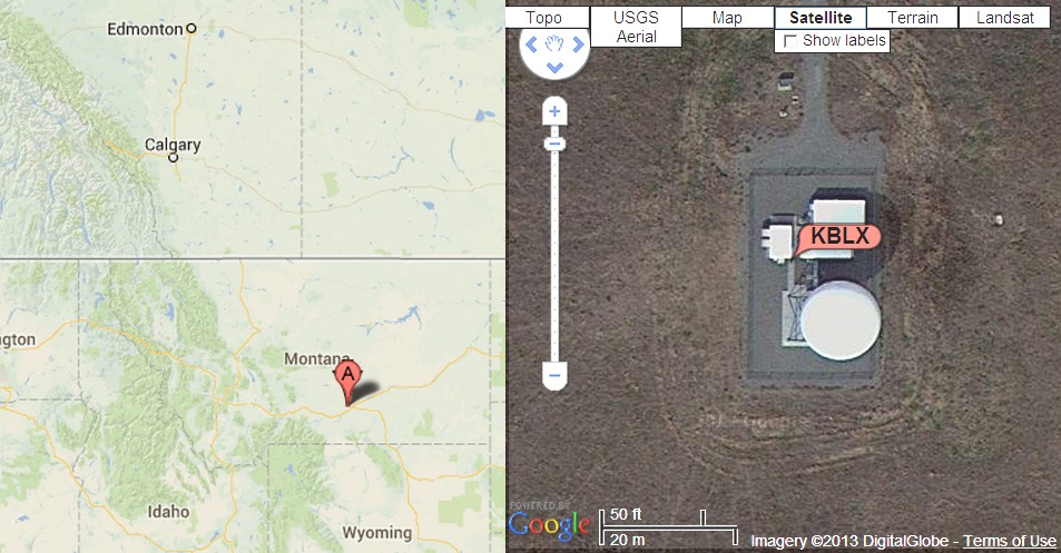 |
| NEXRAD Station KBLX near Billings, MT. Coincidence? |
At about 6 seconds into the video, you will notice that the storm begins in southern Montana, and is actively being fed and driven by NEXRAD station KBLX in Billings, Montana. The storm is also being fed and driven by other NEXRAD stations throughout the neighbouring states, causing it to move east. We see this storm mysteriously originating from specific points of interest, initially starting in Billings, Montana. This is what brought majority of the rainfall in the past day, which caused severe flooding for Southern Alberta.
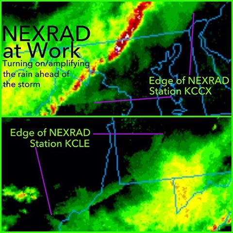
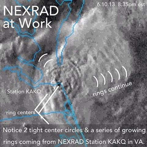
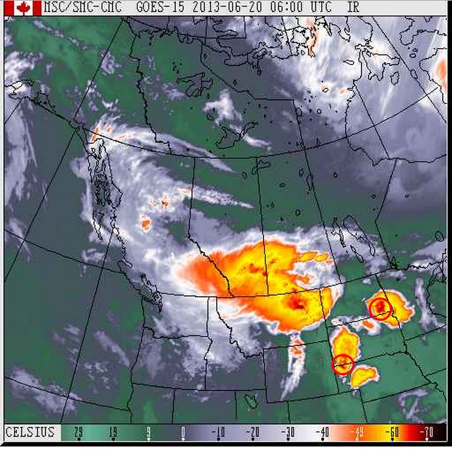 At about 10 seconds into the video, we see numerous other storms mysteriously appearing at central points, specifically in North Dakota and Nebraska. These storms later merge with the one that was created in south Montana. We have uploaded the different NEXRAD animations for these different stations to better depict what was occurring in those areas. You will see the storm systems being fed from some of these locations, and radar pulsing to influence nearby cloud patterns.
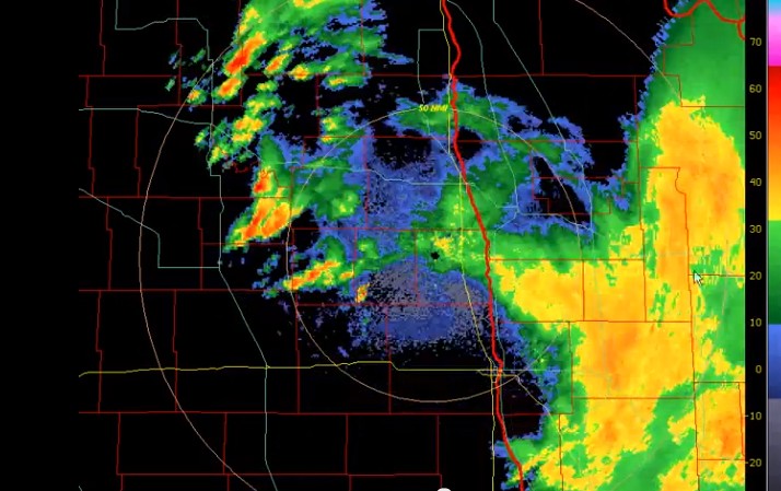 |
| NEXRAD animation screenshot: Grand Forks, North Dakota – NEXRAD Station (KMVX) for June 20 – 21. Notice where this storm system is tapering from–precisely from where the Doppler station is located. |
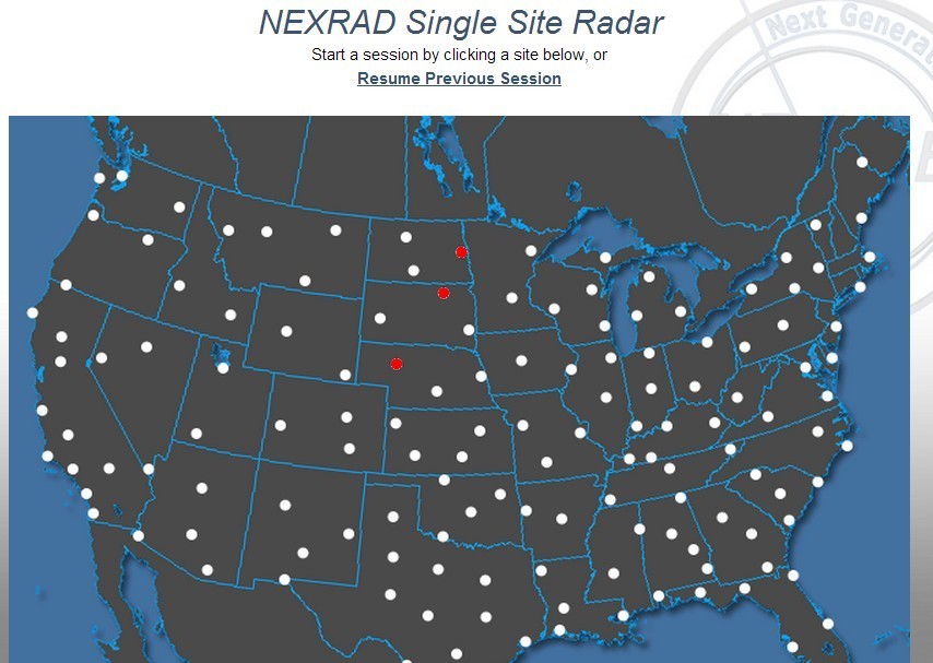 |
| Map of NEXRAD Stations in the United States: White dots represent active NEXRAD stations, and red dots are those of interest to us, specifically in N/S Dakota and Nebraska. We believe that more NEXRAD stations were involved than those which are highlighted red, and stations nearby to them work in conjugation with each other. |
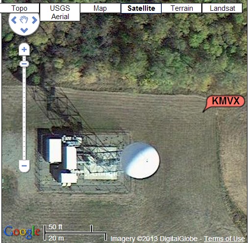 |
| Photograph of the KMVX NEXRAD station in North Dakota |
 With the amount of metal particles in aerosols that are being sprayed (Geoengineering) in the upper atmosphere daily, which actively collect moisture to form clouds, there should be no surprise at how some of these weather patterns are being driven. The clouds laced with metallic particles can be influenced by electromagnetic waves emitted by NEXRAD radar originating from these stations. The air acts like a fluid, in which these particles are distributed.
After watching the NEXRAD animations, one should be convinced that this is not how natural cloud systems are formed. We can clearly see the weather patterns and cloud formations being affected by the electromagnetic waves (ie. radar) emitted from these NEXRAD stations.
More research is needed in this field, and there needs to be a thorough investigation from officials around various States and Canadian cities for the amount of damage that has been caused in the name of weather modification.
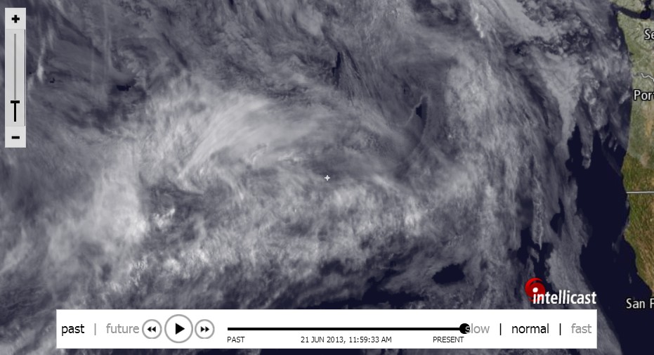 |
| Intellicast Image: June 21st. Active aerosol-spraying continues off the West Coast of U.S. and Canada, which clearly act to intensify active weather systems that are being formed and moving inland. |


Pingback: BREAKING — Heavy rains cause flooding, power outages in Toronto | PN
Pingback: Ontario, Quebec, and Saskatchewan experience extreme weather – Is geo-engineering the culprit? | PN
Pingback: Ontario, Quebec, and Saskatchewan Experience Extreme Weather – Is Geoengineering the Culprit? - | Intellihub.com
Pingback: 9 Strong Points that prove that weather modifications projects have been happening since the early 1900′s | PN